.png)
Working To Make Weather Forecasting Future Ready, Says IMD Chief Mohapatra
IMD Chief says ₹200-billion plan is being prepared to upgrade forecasting tools, techniques and infrastructure.


Rajesh Mahapatra, ex-Editor of PTI, has deep experience in political and economic journalism, shaping media coverage of key events.
June 9, 2025 at 10:57 AM IST
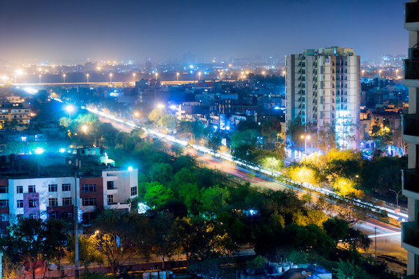
As the weather becomes increasingly unpredictable, there is a need to radically and quickly upgrade forecasting tools, techniques and infrastructure. In the second and concluding part of interview with Dr Mrutyunjay Mohapatra, the director general of India Meteorological Department, says the steps are being taken and there is a strategy in place to make India’s weather forecasting future ready. Mohapatra also reiterates his confidence about the IMD’s forecast of a normal monsoon this year and said the rains will be distributed evenly across most parts of the subcontinent.
Here is the second part of a two-part interview of the IMD head:
Edited excerpts:
Q: Given that extreme weather events might be the new norm, what is IMD doing to improve weather prediction systems, models, and infrastructure to predict these varied events accurately and in time?
A: Initially, our models had a capability of 27 kilometers resolution. When we understood the need for addressing localised extreme events, we introduced models that can go up to a scale of 10 km or 15 km. In 2018, we introduced a global model with a resolution of 12 kilometers, allowing for forecasts every 12 km, and we started providing district and block level forecasts.
We are also augmenting our observational systems. We have increased automated stations, now having one observatory every 25 km, compared to one in 110 km earlier. We had 24 radars until 2014, and now we have around 45 radars across the country. Our target is to have 126 radars. By the end of 2026 or beginning of 2027, we aim to have 74 radars, and the remaining in one or two years thereafter. Radar is more useful for localised events as it has a resolution of 350 meters and can detect cloud behavior and internal properties, whereas satellites have a resolution of 4 km and cannot predict cloud behaviour.
Q: What does IMD do with the data and information it collects from these observatories?
A: Once we have observational data, it needs processing, requiring a high-performance computing system. We started with one petaflop machine, then 6 to 8 petaflops in 2018, and this year added another 20, so we now have a total of about 28 petaflops . This enables us to generate forecasts up to 10 days from morning observations by around 1030 IST and similarly from evening observations.
We introduced a seamless weather forecasting system: seasonal forecasts at the beginning of the season, followed by monthly forecasts, weekly forecasts (every Thursday for the next four weeks), daily forecasts (for the next 7 days), and nowcasting (very short forecast every 3 hours valid for the next 3 hours). This addresses the basic forecasting infrastructure requirement based on augmented observations and computing systems. We have also augmented data communication, utilizing the latest tools and technology comparable to international centers.
Q: With so much data and model outputs, how do forecasters make decisions?A: A forecaster needs a decision support system because it's difficult to take decisions manually with about 300 GB of data being processed every 3 hours. IMD has developed an indigenous digital decision support system. This system has the capability to compare, comprehend, and analyse all types of observational data and data from various models.
Every day, in the morning and evening, we examine about seven numerical weather prediction models run within the country and around three to four run globally. Because models differ, a consensus forecast is generated using the objective decision support system. This objective forecast is then automatically converted into layman's language for weather service communication.
Q: What has been the impact of these advancements on forecast accuracy?
A: All these developments have resulted in an increase in forecast accuracy by 40 to 50%. We are also focusing on reaching the last mile in terms of early warnings reaching each household. Even though climate change limits predictability, forecast accuracy has increased.
We also need to deploy modeling systems that cater to varied needs. The needs of farmers are different from those of disaster risk reduction or fishermen. Customized modeling systems are being introduced, and forecasts are being tuned as per their requirements.
Additionally, we are moving toward forecasting impact. Instead of simply telling what the weather will be tomorrow, you tell what the weather will do tomorrow. We introduced this concept in 2019. For all severe events, impact-based forecasts and risk-based warnings are being provided. For cyclones, it's at the village level (impact and risk assessment). For heavy rainfall, it's at the district level (assessment of risk, impact, and vulnerability). This is also being done for heatwaves, cold waves, and thunderstorms. We need to further improve this by enhancing weather forecasts and also by assessing hazards based on past data. This involves geospatial mapping, digital elevation/surface modeling, and socioeconomic indicators. In a city, for example, you need data on buildings, roads, bridges, culverts, forestry, water bodies, etc., to superimpose weather hazards with secondary hazards, geospatial information, and socioeconomic indicators for real-time, very granular information reaching the household.
Q: This means you need more money, radars, computational systems, and dedicated satellites. Is the ₹20 billion crore allocated under Mission Monsoon enough?
A: When we prepared Mission Monsoon, we targeted more. The current mission plan for 2025 and 2026 is for ₹20 billion, tied to the financial cycle ending in 2026. In an extended manner, perhaps we need around ₹200 billion, and a plan is being put forth for this. So yes, we need more money and more investment.
Q: Some assessments suggest IMD's long-term forecasts have historically been wrong about half the time, and other countries like Australia or the US sometimes predict Indian weather better. How do you respond to this, especially concerning vulnerable sectors like agriculture which are highly dependent on weather?
A: Thank you for your concern, but I do not completely agree with your assessment of weather forecasts. Take cyclone forecasts as an example: in recent times, people have died in the USA from cyclones, but not in India. This shows the improvement in India. Similarly, we have compared heavy rain forecast accuracy in India and the US. Our forecast accuracy is continuously improving, while theirs is almost stabilized, and there is a huge difference. However, comparing heavy rain forecasts between India and the US may not be completely correct because the environments are different. India is a tropical country where weather is triggered by heating and hence convection, which is very random, short-scale, and localized, posing greater predictability challenges. The US is a middle-latitude extratropical country where weather is mainly due to warm and cold fronts not triggered by convection. Therefore, sometimes comparison is difficult. I gave the cyclone example because it's a large-scale system affecting the southern US. Despite the challenges, we are performing better.
Q: What is IMD's seasonal forecast for this monsoon season? You predicted 106% rainfall above the historical average with 90% probability?
A: Seasonal forecasts have less predictability, and many countries don't issue them, but India started in 1878. A recent development in 2021 was issuing seasonal forecasts for the entire country, providing a spatial map indicating the probability of seasonal rainfall (above normal, normal, or below normal) for subdivisions. For the country as a whole, we are expecting 106% rainfall with a ±4% error margin of the long period average (87 cm). This means the expected rainfall can range from 102% to 110% of the average.
Q: What is the probability of above-normal rainfall this year?
A: The probability of occurrence of above-normal rainfall this year is 59%, against the climatological probability of 33%. So, there is a high probability for above-normal rainfall this year. Normal rainfall is defined as 96% to 104% of the long period average.
Q: How has the accuracy of seasonal rainfall forecasts improved recently?
A: I agree that seasonal forecast accuracy was not always good. However, we introduced a new system which is a multimodel ensemble system, using the best five models available globally. We compared the forecast accuracy of seasonal rainfall over India as a whole for 2021-2024 versus 2017-2020. We found that the error in the recent four years was 2.28%, which is within our model error of ±4%. In the previous four years (2017-2020), the error was 7.5%, which was more erroneous compared to the model error. So, for the past four years, the seasonal rainfall forecast accuracy is quite good and within the error limit.
Q: You predicted normal or above-normal rainfall in 30 out of 36 subdivisions. Does this mean the monsoon will be geographically well-spread this year?
A: Yes, if you look at the India map of the forecast rainfall, it shows there will be a uniform distribution of rainfall activity. Most parts will have normal to above-normal rainfall. The exceptions are northeastern states, Ladakh and adjoining Jammu & Kashmir and Himachal Pradesh, some parts of extreme south (southern Kerala and Tamil Nadu), and isolated pockets of Rajasthan. Therefore, if this forecast comes true, it guarantees a good distribution.
(For the first part of the interview, click here)
More From BasisPoint